Promoting Ecosystem Aquaculture
Aquascape mangrove mapping tool
Identifying where shrimp farms are within or adjacent to mangroves can help protect and enhance mangrove habitat.
To help the farmed shrimp industry more effectively identify and protect mangrove habitat, SFP and Longline Environment have developed the Aquascape mangrove-shrimp pond mapping tool, to show where shrimp farming regions and mangrove habitat overlap in India, Indonesia, Thailand, and Vietnam. SFP’s research has found that both abandoned and active aquaculture ponds are providing the setting for mangrove recovery and regeneration.
This provides a huge opportunity for the farmed shrimp industry to help bring back lost mangrove habitat.
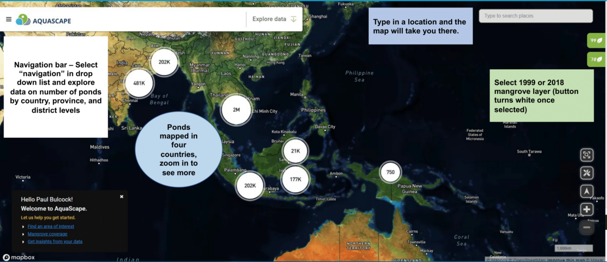
The Aquascape mapping tool landing page, showing where shrimp farms and mangrove habitat are mapped in the four countries.
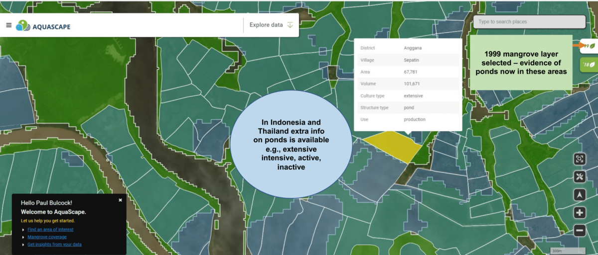
An example of pond-level detail in East Kalimantan, Indonesia.
What Can I Do?
Contact us to learn more about aquaculture and mangroves, the mapping tool, and how we can help you identify target areas for landscape-level mangrove habitat regeneration.